
Earth has four major climate zones spreading north and south from the tropical equator. However, the subtropics receive higher radiation because the cloud cover is thinner and the sun is almost vertical at noon. While the temperate zone is cooler with less radiation, the polar regions are coolest because of Sun’s low angle. Zoning climate change like this reveals the boundaries are shifting in four ways.
What We Learn by Zoning Climate Change
We discover rising global temperatures are altering the climate in these zones. This phenomenon impacts food and water security, local economies, and public health and there are no signs of this trend slowing.
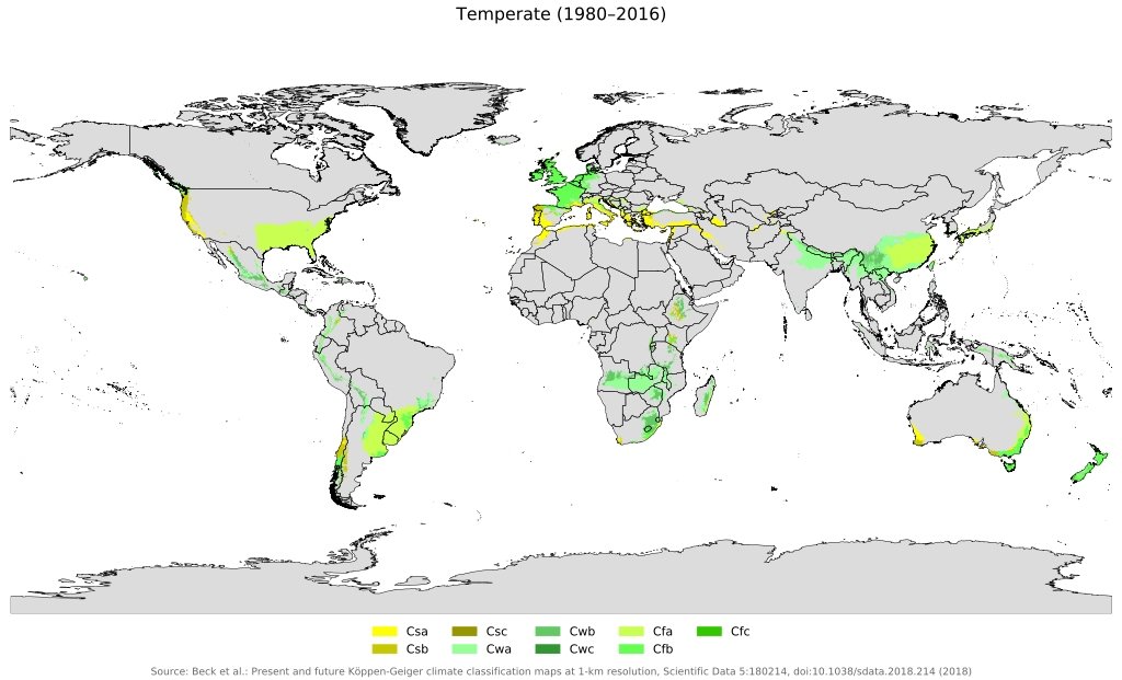
GLOBAL SHIFT 1: The inner tropics are becoming larger by spreading to the north and south. This is where hot air rises, and falls back to earth cooler and drier in the subtropics. GLOBAL SHIFT 2: This “tropical squeeze” is steadily reducing the amount of land where crops can flourish. Put simply, the Sahara – where less than four inches of rain fall annually – has become 10% larger since 1920.
North America is Not Immune from This
GLOBAL SHIFT 3: By zoning climate change we also discover the 100th meridian has moved 140 miles to the east since 1980. This marks the point where the arid western plains of North America and the wetter, eastern region merge.
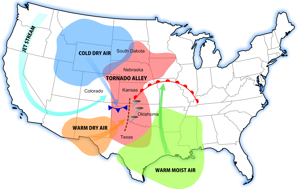
This trend will continue as long as earth keeps warming. GLOBAL SHIFT 4: Tornado Alley has also shifted 500 miles east in the past 30 years. This is why tornadoes are now striking at the heart of Tennessee and Alabama. Oklahoma’s tornado count is down 45%, while Alabama’s grew 48% and Tennessee’s doubled.
Some climatologists believe the shift in tornado distribution matches up with changing weather. However the future for tornado activity is still hard to predict without more evidence, they say.
Related
North America Climate Change: United States
Climate Change Evidence: U.S. Extreme Events
Preview Image: Earth Temperature Zones


